It was “the hike” of all the hikes I’ve done in 10 years of semi-serious hiking.
It was a hike to the rim of a volcano.
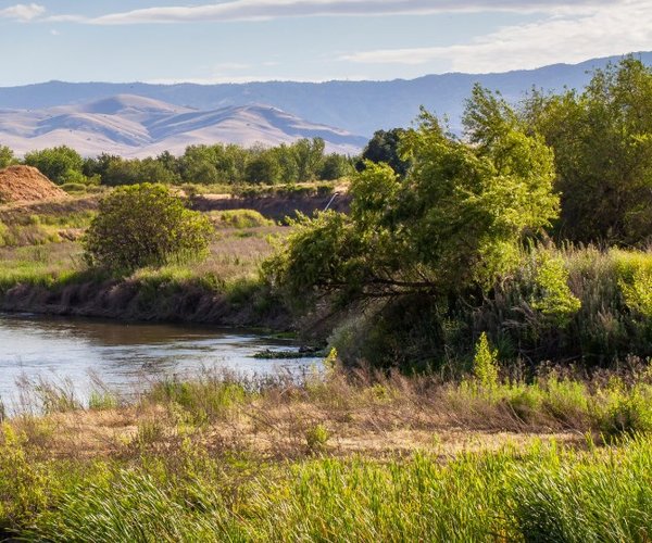
And I didn’t have to go too far to do the hike — just a little over 200 miles and about a four hour drive with just one turn off of Highway 120 after leaving Manteca.
The hike was up Glass Mountain. Its perch is 3,179 feet above one of the world’s six known “super volcanoes” — the Long Valley Caldera. The hike itself is mercifully short covering 2.6 miles round trip. But you gain 1,865 feet in the 1.3 miles from trailhead to the 11,128-foot summit.
Along the way you will hike over and pass more Obsidian rock — basically volcanic glass created from lava as it cooled — than could fill hundreds of gravel trucks.
Glass Mountain is the highest point on the eastern rim of the Long Valley Caldera that covers 20 miles east-west and 11 miles north-south with the most prominent point in the eastern edge being Mammoth Mountain.
The caldera — a giant sunken bowl — is basically a sinkhole created in the most hellish conditions 760,000 years ago when molten lava erupting created a 3,000-foot deep bowl as the earth under it could no longer support the additional weight created from the magna pool pushing upward out of the earth.
The Kilauea volcano eruption in Hawaii as well as the 1980 St. Helens eruption in the State of Washington that killed 57 people, caused $1.1 billion in property damage and sent thick ash cloud into the Midwest are impressive. They aren’t, however, in the same league as the Long Valley Caldera.
Topping the list of super volcanoes is the Yellowstone Caldera beneath where Yellowstone National Park sits. When it was created, the volcanic explosion was 8,000 times greater than St. Helens in terms of ash and lava.
Depending upon whose list you are going by, volcanologists rank the Long Valley Caldera as No. 2 or No. 3. It is believed to have been 3,000 times more powerful than St. Helens based on ash and lava output. You certainly would have felt the shaking from that one if you had been in the Manteca area 760,000 years ago.
The most well-known example of a bowl created by a volcanic collapse is Crater Lake in Southern Oregon.
That said the United States Geological Society (USGS) lists Long Valley as one of three volcanoes in California that are considered very active. The others are Lassen Peak that last erupted in 1915 and Mt. Shasta that erupted in 1786. The state has another four volcanoes including the Mono Inyo Craters just to the northwest of Long Valley that are considered “active” with another 30 plus that aren’t registering as being a threat. Among those are the Sutter Buttes that pop up out of the middle of nowhere halfway up the Sacramento Valley between Colusa and Yuba City.
How active is Long Valley? Between Oct. 29 and Nov. 4, the USGS recorded 13 earthquakes that were all 1.5 or less on the Richter scale.
While you might be alarmed by that, it can be put in perspective: During the past month California recorded 3,604 earthquakes, almost all which most humans can’t feel. Of those four were above 4.0, 33 between 3.0 and 4.0 and 266 between 2.0 and 3.0. The rest — 3,201 — were below 2.0 and not felt by most folks.
California is young geologically as underscored by the volcanoes.
Volcanologists aren’t sounding any alarm bells but consider this: Some form of volcanic eruption is expected every 100 years or so or about the same frequency of a 7.0 or higher quake along the San Andreas fault. The last quake of that magnitude — the 1906 San Francisco quake — registered 7.9. By comparison, the last Lassen eruption was in 1915.
In recent years there have been a number of quakes 3.0 or higher in the Long Valley Caldera. In the 1980s there was a swarm of quakes that ended up lifting half of the 200-square miles of the caldera by 10 inches. Then a decade later carbon monoxide gas created by underground lava escaped from the earth near Mammoth Mountain and killed hundreds of trees.
All in all, 190,000 people in California live in areas considered to be volcano zones.
The most recent eruption in the Long Valley area besides the Mono Inyo Craters 300 years ago that are fed by a different source of underground magna was Pahoa Island in Mono Lake, The island was actually formed by a series of eruptions in the 17th century. The island didn’t exist 350 years ago.
Hiking Glass Mountain
The turnoff to Glass Mountain is roughly midway between Lee Vining and Benton where you can take advantage of a commercial resort built around hot springs.
The United States Forest Service roads to cover the 5 miles to reach the base of Glass Mountain once you turn off of Highway 120 are fairly well maintained and wide for the most part.
I hiked Glass Mountain seven years ago with my nephew after ending a week of day hikes in the Eastern Sierra that ranged from 10 to 22 miles roundtrip. I tossed in Glass Mountain thinking I’d get just as good a workout than going for a run as I normally do on the day I pack up and leave from a base hotel either in Lone Pine, Bishop or Lee Vining.
I did think the 2.3-mile round trip hike might not meet my expectations of a workout given I normally jog about six miles on a travel day. Let’s just say I severely underestimated the workout you get gaining 1,865 feet in elevation in 1.3 miles. There is a reason the hike is rated “very strenuous.”
That said it was do-able on the way up by not trying to beat the clock. Most descriptions described it as a 3 to 5 hour hike depending upon your ability. We did it round trip in about 3½ hours after turning off Highway 120 and driving 5 miles on Forest Service roads.
I’d be remiss not to confess to slipping twice coming down on the steep scree covered trail even though I had hiking poles. The first time I got a little carried away with my pace. The second I got off the trail and — much to my nephew’s delight — was forced to slowly slide on my rear down an extremely steep part of the mountain for about 40 yards before I was able to rejoin the trail that had switched back below.
The hike was my favorite by far when it comes to the reward at the top. The vista, thanks to being on what is the rim of a volcano more than 3,000 foot above the floor, was unlike any other. I’d say it was the best view looking toward the Eastern Sierra you’ll find along Highway 395 that you cross driving Highway 120 to the Glass Mountain access road. Landmarks such as Mt. Dana in Yosemite, Mammoth Mountain, Tioga Canyon, and Mono Lake were easy to pick out. The fact I could lay on my stomach and look down 3,000 feet and soak in the fact I was on the edge of a super volcano gave me a unique perspective of where I live.
And, perhaps most important, it was the only peak outside of Death Valley I’ve been able to summit and return to the trailhead without passing another soul. The last visitors before us were 22 days prior based on the summit registry when a Boy Scout Troop out of Reno with 12 members tackled Glass Mountain. That’s my idea of solitude.
You could always drive across the caldera on Highway 395 but you honestly get no inkling of the amazing geological feature that is in the 209’s backyard just a relatively short drive east of Yosemite National Park.
It also makes you realize how great it is to be along the 152.6-mile ribbon of asphalt that takes you from the edge of the Delta, up through the Gold Country, into Yosemite National Park, within four miles of the most accessible 13,000 plus peak in California to hike, past the prehistoric Mono Lake, and by a super volcano.