No offense, but California 1 is not the most breathtaking highway in the Golden State.
Yes, California’s western most highway starting near Dana Point in Orange County passes through the storied beach towns of Southern California, skirts the edges of Los Angeles and San Francisco, hugs the rugged Big Sur coast, crosses the majestic Golden Gate Bridge, and winds through towering redwoods before ending in Legget in Mendocino County.
Its 656 miles makes it the longest state highway in California.
But when it comes to natural highs it doesn’t come close to Highway 120 that soars to 9,945 feet at Tioga Pass, the loftiest pavement in the state highway system.
Day in and day out when most think of Highway 120 it’s the 6-plus mile rolling parking lot known as the 120 Bypass. The highway, though, is much more than just the bane of frustrated commuters. It offers a magical carpet ride on asphalt that allows you to savor nature’s handiwork including a sediment filled inland sea, four glacial ages, the sub-snail pace uplift of the Sierra, and the aftermath of massive volcanic eruptions.
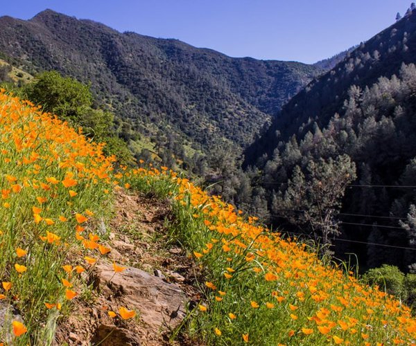
Highway 120 takes you across the most fertile and productive valley in the world, allows you to access the stunning glacier carved Yosemite Valley, takes you through Tuolumne Meadows surrounded by majestic granite peaks, descends 3,000 feet along the edge of the epic Tioga Canyon, passes the remnants of a prehistoric lake formed 760,000 years ago that is now known as Mono Lake, runs just north of the Long Valley Caldera that is among California’s active volcanoes, and swings through Benton with its rustic hot springs.
The route starts on the edge of the Delta just north of Mossdale Crossing on the San Joaquin River with its junction with Interstate 5. It runs through San Joaquin, Stanislaus, Tuolumne, and Mono counties.
Along the way it winds up the New Priest Grade with its 100-plus sharp hairpin turns east of Don Pedro Lake. It was built as an alternative to the original Priest Grade with its 17 percent grade that tests engines on the way up and puts the heat on brakes on the downhill.
Through Yosemite National Park it becomes Tioga Road where short excursions take you to the largest living things on earth — giant sequoia trees.
Why Highway 120
seems so magical
I’ve been enamored with Highway 120 ever since June 20, 1989 when I first turned onto the highway.
It was just outside of Lee Vining, 160 miles east of Manteca, The Family City.
I also was not driving a car. Instead I was pedaling my way up Tioga Canyon on a fully loaded touring bicycle laden down with 30 pounds of gear in the 25-pound bike frame.
While the 10-mile grind to gain 3,000 feet in elevation is something my quads may want to forget, what has stuck with me was the fact it started to snow within 300 yards of my turning off Highway 395.
Snow on the first day of summer in the high Sierra is not rare. But the snow by the time the highway flattened out near Ellery Lake had accumulated an inch on the pavement.
It was the first time I had bicycled in snow or up that long of a sustained grade.
I was ready for it as I had packed lined tights, a cold weather jersey, and winter cycling gloves, rain gear and even water-proof “booties” for my cycling cleats.
You always prepare for weather changes in the high Sierra. My cycling partner at the time was an 18-year-old high school senior who was 6-foot-4, and weighed 140 pounds dripping wet without an ounce of fat on him and also had winter gear he was wearing over summer cycling shorts and short-sleeved jersey.
A mile into the climb Brian was shivering uncontrollably becoming squirrelly on the racing bicycle he was riding. That is not a good combination with drivers — many not used to driving in snow — passing us within several feet.
At the time I was 20 more pounds than I weigh now, which in hindsight was a good thing. I literally gave Brian the clothes off my back and my winter gloves given he only had summer gloves. And although I had a somewhat thicker pair of summer cycling shorts in my panniers there was no way I could change in the snow out of the thinnest cycling shorts I had out in that day assuming I would sweat profusely wearing long tights.
As Brian put on two more layers of my larger sized gear including items I retrieved from my saddlebag he joked about going from an Otter Pop to the Michelin tire man.
When it stopped snowing near the Tioga Resort we pulled over so Brian could shed two of his four layers.
It was there where a Scout leader with his charges that looked at us like we were idiots — you know the look — said out-loud five words I’ll never forget – “now those guys are crazy.”
But to be honest even though I had summer gear with shorts, short-sleeved jersey, open finger gloves and soaking wet cleats I wasn’t cold. The 3,000-foot climb kept me warm.
I wished I could say the descent once we left Tuolumne Meadows was less eventful.
It produced another first for me — riding downhill at 20 to 30 mph riding the brakes in a hailstorm that lasted 8 to 10 minutes.
In retrospect, we should have pulled over but we were on an exposed section of roadway with no trees after you pass Tenaya Lake so I assumed — incorrectly — that it made sense to keep going instead of standing alongside the road like two idiots holding up our bicycles while getting pelted with hail.
Instinctively I kept my head down and peered over my sunglasses. Brian did not. He ended up with bloody lips and pits in his sunglasses.
If you think hornets sting wait until you are pounded with what seemed like thousands of pieces of frozen ice being fired at you from the heavens while passing through it at 20-25 mph.
And in case you’re wondering ice caught on your brake pads are a great way to carve unique circular patterns into a $400 pair of bicycle rims.
First trip on Bypass was
in zero visibility fog at
8 p.m. on New Year’s Eve
I took my first trip by car on Highway 120 that holiday season heading to San Jose to celebrate New Year’s Eve with some friends.
I was living in Lincoln at the time and they said the quickest way was to take something called the 120 Bypass.
I was worried about missing the exit in the darkness given the forecast correctly predicted near zero visibility in spots in the valley due to fog. My friends said I’d be able to “smell” it when I was near the exit referencing sugar pulp from Spreckels Sugar.
Two years later I finally ended up taking old Highway 120 (Yosemite) into Manteca. That was in 1991.
And as ironic as it might sound I’ve lived 27 of the past 30 years within a half mile of Highway 120 in three different locations including rural Ripon and 26 of those years less than two blocks from Spreckels Sugar and eventually Spreckels Park.
I’ve taken Highway 120 to reach Yosemite Valley or through the high country into the eastern Sierra easily 120 times since then including five times on a bicycle.
The drive never disappoints.
It has given me access to points such as sitting atop the 11,160-foot Glass Mountain strewn with black obsidian rocks formed from cooled lava on the lip of the Long Valley Caldera — think arrowheads — and savoring the horizon from the 13,061-foot summit of Mt. Dana on Yosemite Park’s eastern boundary to hiking in two feet of snow in mid-July beyond the northern shores of Saddlebag Lake at 10,800 feet.
The ocean is amazing but I’ll take the mountains any day.
And nowhere in California is a highway that packs such a variety of mountains — from the Sierra to the Great Basin — along its route than Highway 120.